A groundbreaking discovery has been made beneath the East Antarctic Ice Sheet, where researchers led by Stewart Jamieson from Durham University have uncovered an ancient, river-carved landscape that has been preserved for over 34 million years. This landscape, buried under nearly two kilometers of ice, has remained untouched since long before glaciation began in Antarctica. The revelation provides an extraordinary view into the continent’s past—an era when Antarctica was not the icy desert we know today, but a lush, habitable environment.
Unveiling a Lost World Beneath the Ice
The discovery, published in Nature Communications, was made possible by cutting-edge satellite technology, specifically the RADARSAT Canadian satellite system, which allowed the team to detect minute variations in the ice surface. These changes revealed the shape of the land buried beneath, leading to the identification of a large ancient landscape, roughly the size of Wales. What the team found was a river-carved terrain, containing valleys, ridges, and channels, all preserved under the thick ice.
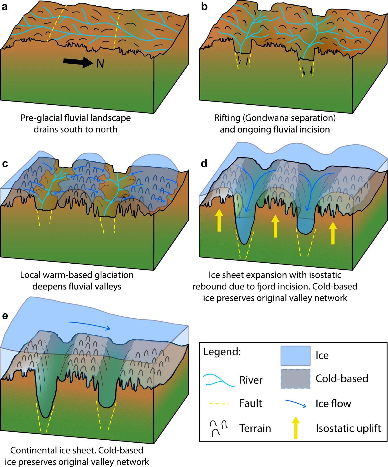
According to Stewart Jamieson, uncovering this ancient terrain is akin to “opening a time capsule.” The condition of the landscape suggests it has remained virtually unchanged for millions of years, preserved under the immense weight of the ice sheet. The discovery of this ancient world is particularly significant because it dates back to a time when Antarctica was part of the supercontinent Gondwana—a period long before the ice sheet took hold. In this ancient era, Antarctica was home to flowing rivers, forests, and even dinosaurs.


Antarctica’s Pre-Glacial Past
The newly uncovered landscape helps paint a picture of a very different Antarctica—a continent that, millions of years ago, was much warmer and wetter than it is today. Instead of ice and snow, rivers once flowed through the land, and forests dotted the terrain. This is a time when Antarctica was still connected to other landmasses in Gondwana, which included Africa, South America, and Australia.
The research team’s findings provide a rare glimpse into this prehistoric environment. According to the study, the land beneath the ice has been frozen for millions of years, with the glaciers that eventually overtook the continent emerging only around 20 million years ago. The finding underscores how drastically Antarctica’s climate has changed, from a lush, forested land to the cold, icy desert we know today.
Mapping the Ancient River Networks
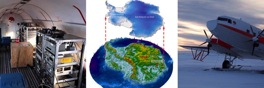
Using a combination of RADARSAT satellite imagery and radio-echo sounding (RES) surveys conducted by the International Collaborative Exploration of the Cryosphere through Airborne Profiling (ICECAP) project, the team mapped the intricate subglacial topography. The survey revealed valleys, ridges, and channels that point to an ancient river system. These features suggest the landscape was once shaped by flowing water, not ice, providing an important clue to the climate and environmental conditions of ancient Antarctica.
The discovery of these river systems is significant for several reasons. Not only do they offer insights into the past environmental conditions, but they also help scientists better understand how ancient rivers shaped the land before the onset of glaciation. The features observed in this ancient landscape have been preserved beneath the ice sheet, offering rare insights into Earth’s climate history.


The Dynamics of the East Antarctic Ice Sheet
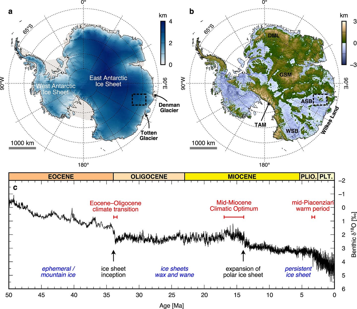
The study provides a new window into the evolution of Antarctica’s ice sheet. The East Antarctic Ice Sheet (EAIS) began forming around 34 million years ago, during the Eocene-Oligocene transition, when global temperatures dropped and CO2 levels fell below critical thresholds. Over millions of years, glaciers expanded, coalescing into the massive ice sheet we see today. Understanding the landscape beneath the ice is key to understanding how the ice sheet has changed over time.
The research team’s findings suggest that the region’s topography was shaped by ancient rivers long before the ice sheet grew. The study of these subglacial features can help scientists understand the dynamics of the EAIS, which has undergone significant fluctuations throughout its history, including periods of retreat during warmer climate intervals like the mid-Pliocene and Pleistocene.


By mapping hidden mountain ranges, canyon systems, and lakes beneath the ice, the team has provided new insights into the ice sheet’s past dynamics and the role of ancient river networks in shaping its underlying terrain. The study’s results also have significant implications for predicting how the ice sheet might behave in the future in response to rising global temperatures.
The Role of Satellite Technology
The study utilized a combination of satellite technology and geophysical surveys to map the ancient landscape. The RADARSAT constellation proved invaluable for detecting subtle surface changes in the ice, revealing the contours of the land beneath. In addition, the team used radio-echo sounding (RES) to gather data on the subglacial terrain, providing a clearer picture of the landscape’s topography.
Flexural modeling was also used to understand the landscape’s evolution. This modeling helped the team evaluate how the land’s surface has been altered over time, particularly by the forces of glaciation. The team found that the ancient land was shaped by fluvial erosion before the ice sheet formed, which suggests that rivers played a significant role in shaping Antarctica’s landscape millions of years ago.
Implications for Climate Science
The implications of these findings extend beyond understanding Antarctica’s past. The preservation of these ancient landscapes beneath the ice offers valuable data for predicting how the ice sheet might respond to modern climate change. As global temperatures rise, understanding the behavior of the EAIS is crucial for forecasting sea-level rise, since changes to the ice sheet’s size and stability can significantly impact global sea levels.
This research underscores the importance of continued monitoring of the EAIS. By linking ancient landscape features to past climate conditions, scientists can refine models that predict the ice sheet’s future behavior. Such knowledge is crucial for informing global strategies to mitigate the effects of climate change and prepare for potential consequences of rising sea levels.
Source link


