- Last First Alert Weather Day: Today
- Warm nights through midweek
- Cooler for Labor Day Weekend… Maybe some showers?
Don’t forget to download our FOX 12 Weather App to stay ahead of the forecast! Get real-time radar, updates from our team, and exclusive content right at your fingertips.
Check out Mark Nelsen’s latest Weather Blog
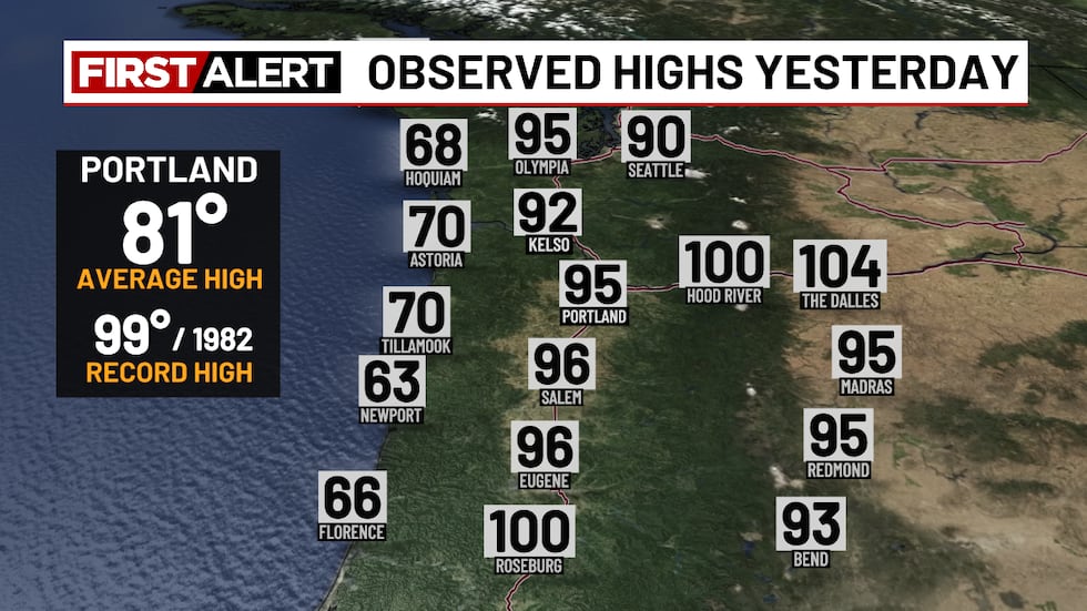
WEEKEND RECAP:
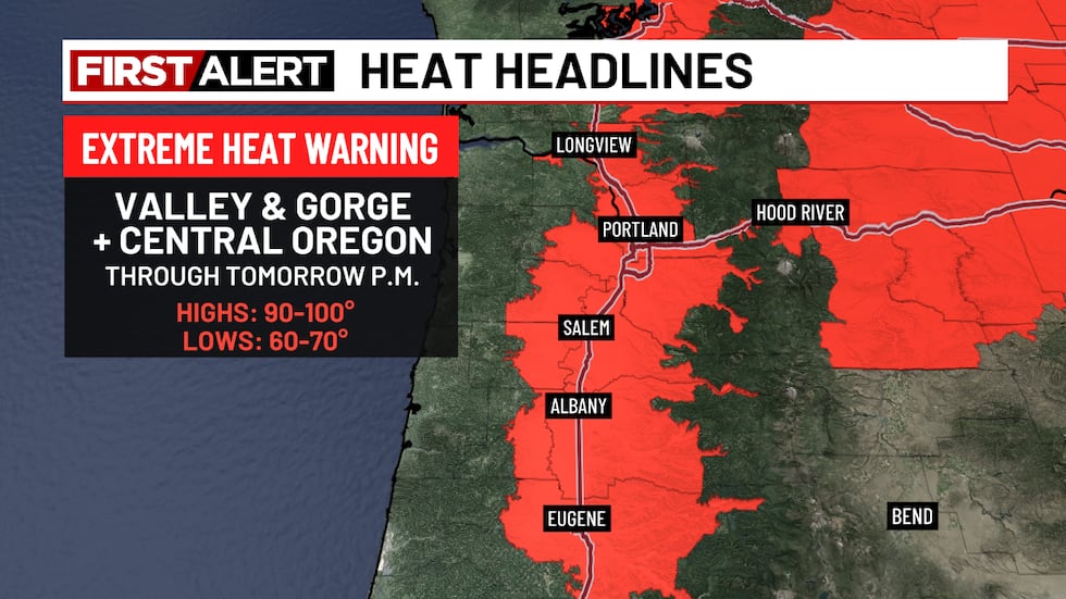
Yesterday’s highs ranged from the low 90s in southwest Washington to the low 100s in Roseburg, with coastal areas in the 60s and 70s and triple digits through the Gorge. This marked the third straight day of our heat wave, with a fourth expected today.
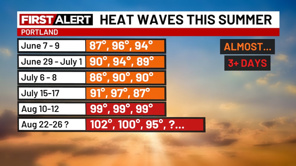
HEAT WAVE CONTINUES:
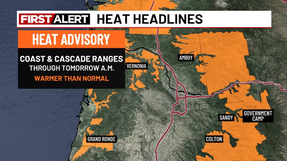
Some showers are developing this morning over the Central Oregon Cascades, thanks to moisture moving north out of California and Nevada. The bigger story continues to be the heat. The strong high-pressure system that’s been driving this heat wave is finally starting to weaken. Added clouds from the incoming moisture should help keep daytime highs a little lower than they have been over the last few days; however, this is now the fourth consecutive day of extreme heat. Overnight lows will stay warm for the next few mornings.
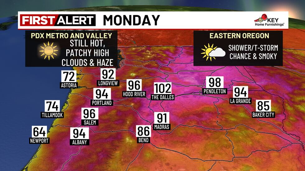
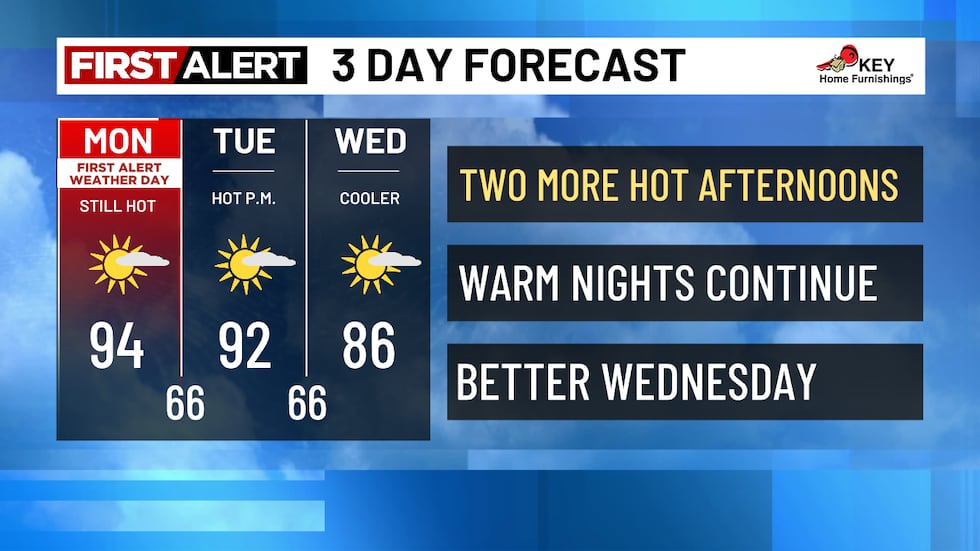
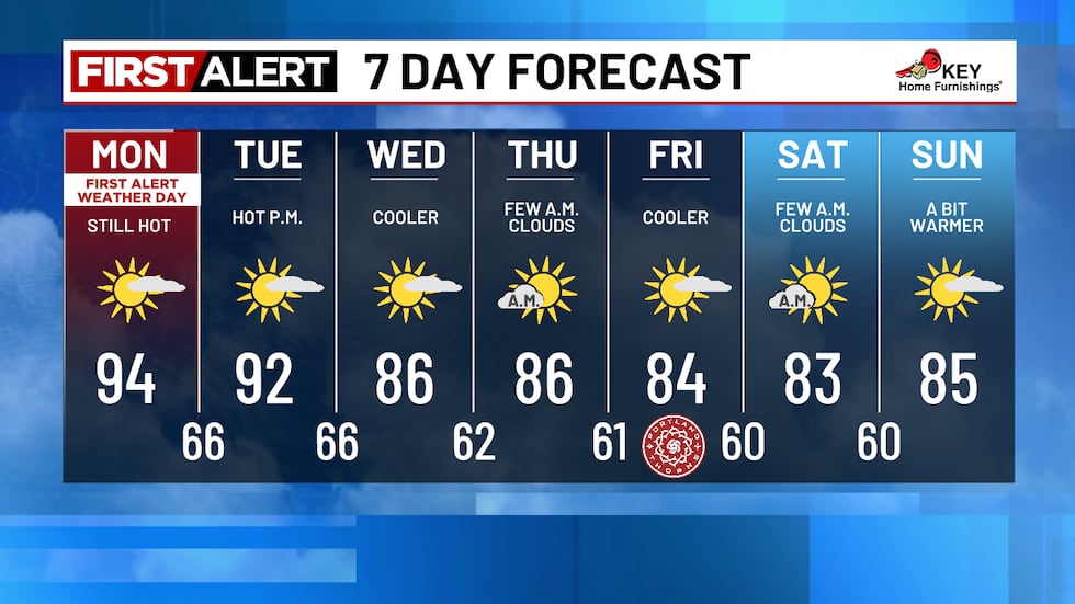
Tomorrow looks similar—slightly lower temperatures, a bit more cloud cover, and a small chance for showers or thunderstorms, mainly in the Cascades.
CURRENT HEAT ALERTS:
LATER THIS WEEK:
By midweek, a shift in the weather pattern should finally bring some relief. A broad low-pressure system from the Gulf of Alaska will move into the Pacific Northwest, helping drop temperatures closer to normal by late week. Highs could dip into the low 80s, accompanied by onshore breezes and higher humidity.
Copyright 2025 KPTV-KPDX. All rights reserved.
Source link
")
