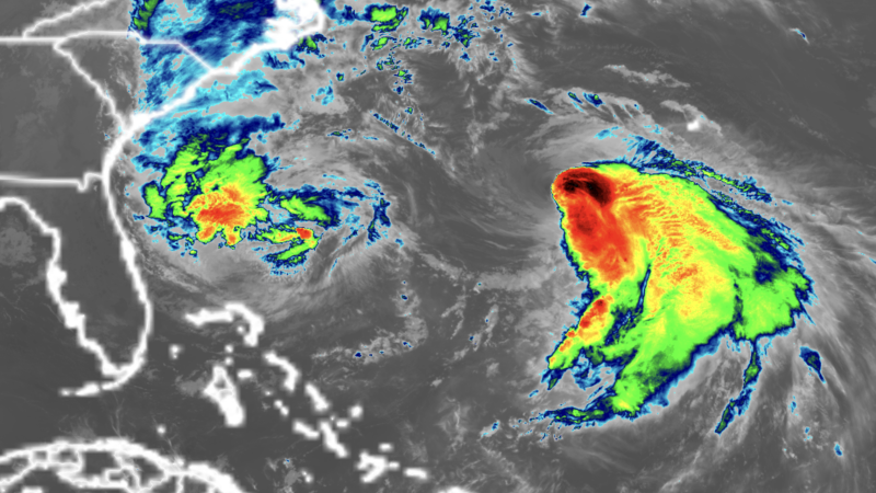
Hurricane warnings are flying for the island of Bermuda as a strengthening Hurricane Imelda barrels toward a close encounter with the island, expected to occur early Thursday morning. As of 11 a.m. EDT Wednesday, Imelda was centered about 340 mi (550 km) west-southwest of Bermuda, heading east-northeast at 20 mph (31 km/h) with top sustained winds of 100 mph (155 km/h) and a central pressure of 966 mb.
Satellite imagery at midday Wednesday showed that Imelda had closed off an eye, which was surrounded by intense eyewall thunderstorms with cold cloud tops. Conditions were marginal for development, with high wind shear of 20-25 knots, warm ocean temperatures of 28 degrees Celsius (82°F), and an increasingly dry atmosphere. However, Imelda was strengthening by pulling energy from a trough of low pressure that it was becoming embedded in.


Forecast for Imelda
Imelda’s east-northeastward motion will continue for the next few days, bringing the hurricane very close to Bermuda early Thursday morning. Imelda is expected to get a boost of energy from the jet stream as it begins to transition into a powerful extratropical storm near Bermuda. This process could lead to the development of a dangerous “sting jet” – a narrow band of violent and destructive winds along the back side of Imelda that quickly descends to the surface. The National Hurricane Center, or NHC, was predicting that Imelda would peak as a Category 2 hurricane with 105 mph (165 km/h) winds at 8 p.m. EDT Wednesday, about six hours before hitting Bermuda.
After Imelda passes Bermuda, its long-term fate is uncertain, but NHC is predicting that the storm will continue heading east-northeastward out to sea, becoming extratropical on Thursday.
Bermuda hurricane history
Bermuda is one of the most hurricane-prone and hurricane-proof places in the world. Just last year, Hurricane Ernesto made landfall on the island as a Category 1 hurricane with 85 mph winds. Ernesto led to downed power lines and many downed trees, with more than 75% of the island (over 25,000 customers) losing power, which took several days to restore. Overall damage to structures and housing was relatively minor, and one gas station observed some roof damage from Ernesto’s winds.
A Category 2 or stronger hurricane passes within 25 miles of Bermuda about once every 10 to 12 years, usually in September or October. The last Category 2 or stronger hurricane to hit Bermuda was Cat 2 Hurricane Paulette, whose eye moved over the northeastern portion of the island on September 14, 2020, knocking out power to the entire island. However, only minor damage was reported on Bermuda, which may be the most hurricane-hardened place in the entire Atlantic. It has been over 20 years (since Fabian in 2003) since a hurricane-related death has been reported in Bermuda.
The rest of the Atlantic is quiet
At 11 a.m. EDT Wednesday, NHC issued its last advisory on Hurricane Humberto, which had merged with a front in the central Atlantic. NHC’s Tropical Weather Outlook was not advertising any new threat areas that might develop in the next seven days.
Bob Henson contributed to this post.
