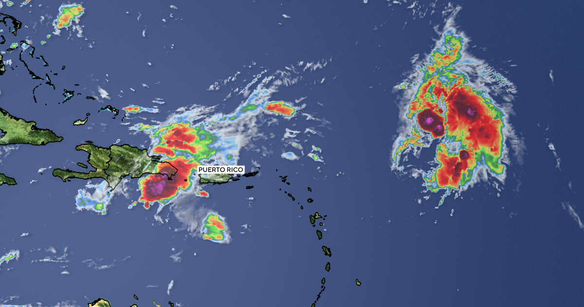
There were two named storms in the Atlantic Ocean on Thursday, Gabrielle and Humberto.
But it’s a storm that doesn’t have a name that many in the U.S. will be watching closely.
That system, which is being called Invest 94 for now, was causing rain, storms and gusty winds across parts of the Dominican Republic and the Turks and Caicos Islands on Thursday.
The National Hurricane Center expects the system to become a tropical depression late Friday or over the weekend.
It could be near the central and northwest Bahamas when that happens.
It’s too soon to say whether the disturbance will head toward the U.S., but the hurricane center said those along the Southeast U.S. Coast should keep a close eye on the disturbance in the coming days.
“While there is significant uncertainty in the long-range track and intensity of the system, the chances of wind, rainfall, and storm surge impacts for a portion of the southeast U.S. coast are increasing,” the hurricane center said Thursday afternoon.
A system has to have a defined center of circulation and winds of at least 39 mph to be considered a tropical storm and get a name. The next name on the 2025 storm list is Imelda.
There is a long list of factors that could influence where the potential Imelda could go, including a trough of low pressure expected to move off the East Coast and nearby Tropical Storm Humberto, which is forecast to become a major hurricane, possibly as soon as this weekend.
TROPICAL STORM HUMBERTO

As of 4 p.m. CDT Thursday, Tropical Storm Humberto was located 470 miles northeast of the northern Leeward Islands and was tracking to the northwest at 6 mph.
Humberto, which developed on Wednesday afternoon, was strengthening and had 60 mph winds on Thursday afternoon, according to the hurricane center.
Hurricane-force winds begin at 74 mph.
There were no watches or warnings in effect for the storm so far.
Forecasters said Humberto is expected to stay on a west-northwest path for the next few days, but its long-range track will depend on the evolution of the would-be Imelda to its west.
Humberto could become a hurricane on Friday and a Category 3 hurricane by the weekend, according to the hurricane center.
POST-TROPICAL CYCLONE GABRIELLE

Last but not least was Gabrielle in the north-central Atlantic. Gabrielle became a non-tropical system on Thursday afternoon but had winds up to 70 mph.
Gabrielle is no threat to the U.S., but the storm should move near or over some of the Azores islands starting as soon as tonight. Hurricane warnings remained in effect on Thursday for all of the Azores.
The hurricane center said hurricane-force winds and hazardous seas were expected in the islands later tonight and early Friday.
As of 4 p.m. CDT Thursday, Post-Tropical Cyclone Gabrielle was located 265 miles west-southwest of the Azores and was tracking to the east quickly at 31 mph.
Gabrielle could bring a dangerous storm surge to the islands as well as 3 to 5 inches of rain.
Gabrielle is expected to transition to a non-tropical system after it passes through the Azores.
There were no storms expected to develop in the Gulf in the next seven days. The Atlantic hurricane season ends on Nov. 30.
If you purchase a product or register for an account through a link on our site, we may receive compensation. By using this site, you consent to our User Agreement and agree that your clicks, interactions, and personal information may be collected, recorded, and/or stored by us and social media and other third-party partners in accordance with our Privacy Policy.
Source link

